If you're a canyon veteran, I'm going to apologize in advance for leaving anything out. (Please leave a comment and tell me what I missed.) If you've been to Palo Duro Canyon before but don't really remember much, let this serve as a refresher. And finally to those who have never been to the canyon, I hope I provide enough information to give you an idea of what to expect but not enough to spoil the experience of your first time out there.
Anyone who knows me or has kept up with this blog should know that I am extremely proud of Palo Duro Canyon. But never let it be said that I'm not equally appreciative of those who have taken the time to make it such a wonderful place to go trail running. The trails are in great shape and have a good variety of difficulty and technicality, and they didn't get that way because of deer or cattle or a band of magical elves with construction hats and tiny shovels. So let this guide be dedicated to those folks - Red Spicer, Bill and Wynn Ross, Kevin McClish, et al. - who gave up countless hours of their free time so that goofballs like me can have such a fun and amazing place to go trail running. I just hope that one day I can look back and say I ran these trails, and made a respectable attempt at working on them, as much as they did.
Update: After corresponding with Bill and Wynn Ross, there are a few more individuals (by no means though is the list complete) who deserve recognition for the contributions they've made to the beauty and success of the PDC trail system:
- Bill Snure
- Chris Villagomez
- Jason Bass
- Bryan and Nuggett Quillin
Thanks, guys!
Notice: you may consult or print this park map for additional reference.
How to Get to the Starting Line (Juniper Day Use Area)
After you've entered the park there's really only one way to go, so just stick with it for a while and take care not to hit any deer. The road will wind and turn and go downhill until you eventually get to the bottom of the canyon. What you're initially going to be looking for are river crossings, so don't let anything else distract you.
 |
| River Crossing #1 |
 |
| River Crossing #2 |
 |
| Lighthouse parking |
Back to the driving directions. You'll want to really slow your vehicle down once you reach river crossing #2, because it will be dark and this is where a lot of people have gotten lost in the past (me included). Immediately after the Lighthouse parking area is Alternate Park Road 5. Turn here. Do not go straight/left. Most likely it will be marked before race day, but you can look for the road sign just in case it isn't.
 |
| Juniper Day Use Area entrance |
The Bottom Loop (First Half)
Juniper camp: start/finish, restrooms, an aid station, and post-race burgers can all be found at this spot. Toe the line, take a deep breath, and get ready to have a great, great run!
 |
| Juniper Trailheads |
 |
| Juniper Cliffside |
 |
| Juniper Cliffside |
One significant thing about this section though is the inspiring landmark named after one of the most well-liked people to ever walk these trails. I'm talking of course about the late J.M. "Red" Spicer, former director of the PDTR and one of the folks who helped create and maintain a lot of this course. It's at this landmark that many runners, myself included, pay their respects by tapping the rock every time they pass by.
 |
| Red's Rock - Juniper Cliffside |
 |
| Juniper Cliffside exit |
The Top Loop
 |
| Lighthouse Trailhead |
 |
| Lighthouse Trail |
As I hinted earlier, the Lighthouse trail doesn't have much in the way of trees. Or anything that gives you shade really. Right around the 1.1 mile marker there's a cliff that provides some protection from the sun, but forget about that after 9am or so. The trail is nice though, starting out flat, then gradually going uphill into a mix of surfaces and elevations. There are plenty of open spaces as well, similar to what you saw on Juniper Cliffside.
 |
| Lighthouse-GSL junction |
Now when I say "demanding," I don't mean GSL is super hard or anything, because none of the trails at Palo Duro Canyon are super hard. But there are a few relatively lengthy uphills, and there's quite a bit of loose, gravely rock, and there are some tight, winding corners (in a section I call The Racetrack). And running it in the middle of the summer can be brutal and make you wish you had brought more water. But having said that, this is definitely my favorite section of the course. Maybe it's because of the increased difficulty or maybe it's because of the scenery. I don't know. There's even a spot where I bonked once (it's a long uphill starting at the .6 mile marker), instantly becoming a zombie and dragging my knuckles the 4 miles back to Juniper camp. But I try to run it almost every time I go out and I'm like a kid at Christmas when I do.
 One important note about the first quarter mile or so of GSL. There will be a creek bed that you'll cross over, and immediately take a left after you do. This isn't really part of GSL proper, but instead an addition that was made a few years back to increase the length of the course. Just a small detour, nothing big. About 400 yards in you'll come across another fork. Go right this time and you'll quickly see the 6 mile course marker. From there it's a hop and a skip to the GSL-Little Fox junction.
 Now you're at the famous Dos Loco Senioritas aid station. Maybe you even heard these great ladies before you got there, whooping and hollering at the runners ahead of you. There won't be as many treats at this station compared to the others since it's not exactly close to the main road, so plan accordingly. From here, you'll take a left and continue on down GSL.
Cottonwood Flats - GSL Trail
|
 |
| The Moon - GSL Trail |
| Cairn - GSL Trail |
| Givens, Spicer & Lowry Trailhead |
 |
| Paseo del Rio Trailhead |
 |
| Paseo del Rio exit |
The Bottom Loop (Second Half)
| Rojo Grande Trailhead |
 |
| Alt Road 5 - Rojo Grande |
 |
| "El Viejo" - Rojo Grande Trail |
 |
| Rojo-Sunflower junction |
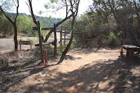
About a mile later you'll come out of the trees and see the main park road. Keep right and you'll go right back into the trees, only now you'll be on Sunflower trail which will seem like a mix of Rojo and Juniper Cliffside. After another mile or so, you'll come to another fork. In the picture below, taken the day before a bike race, you can see that some folks obviously have a hard time reading signs so the trail is taped off. Ha! Us runners need no such help! <grab crotch, spit> Just veer left onto Juniper Riverside and you'll be headed for home.
 |
| Juniper Riverside-Sunflower junction |
There isn't a lot to say about JCR that hasn't already been said about the previous few miles. The section is flat, narrow, and provides brief moments of shade. Simply keep running knowing that the Juniper camp is just up ahead!
And that's it. That's the course. Easy peasy, bacon greasy. If you're a 20K runner, WOOHOO! Grats, you did it! But if you're running either of the 50s? Sorry, kiddo. You have a ways to go still.
Summary
Hopefully this has served as a fairly informative guide on what to expect while participating in a Palo Duro Trail Race. And more importantly, I hope I've shared some of my enthusiasm with you regarding how awesome of a place it is to visit. I've run through this course many, many times now, yet I'll be swept up by its beauty on race day as much as I was during my first time out.
In closing, I want to ask that you please, please, no matter who you are or how competitive you plan on being, slow down every so often and look around; especially at sunrise. You'll likely be upset with yourself later if you don't. Because being on the trail isn't just about physical fitness. It's an escape from the modern world, a nod to our ancestors, and it's sadly becoming a rare occasion that only the lucky ones get to truly experience. I feel it's our duty to appreciate not only the opportunity that we've been given, but also our physical ability that affords us that opportunity. The badge we put on every time we go out is that of a trail runner, but it's not pride that makes us wear it. It's humility and reverence. We take care of the trail and it takes care of us. So again, pause for a moment. Smile at yourself and at your fellow runners. And allow the smells and sights and sounds remind you of what running used to be before they paved paradise and put up a parking lot.
And if I can't convince you of how vital it is that we allow running to help define who are, maybe Roger Bannister can.
"We run, not because we think it is doing us good, but because we enjoy it and cannot help ourselves. The more restricted our society and work become, the more necessary it will be to find some outlet for this craving for freedom."
 |
| Jump strong. Fly swift. Land soft. |


